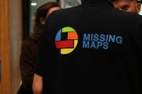
Missing Maps
Missing Maps is an international, open humanitarian project founded by the American Red Cross, British Red Cross, Humanitarian OpenStreetMap Team, and Médecins Sans Frontières. Its mission is to map regions that are especially vulnerable to natural disasters, armed conflict, and disease outbreaks. Many of these areas remain poorly documented in existing map systems, which significantly complicates the work of humanitarian organizations attempting to deliver aid or coordinate emergency response.
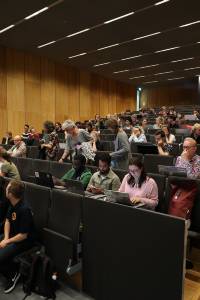
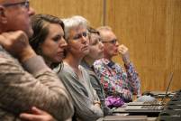
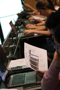
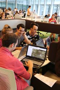
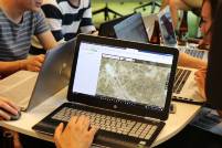
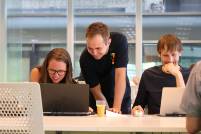
By producing accurate, up-to-date map data, Missing Maps enables field teams to make informed decisions, plan interventions more efficiently, and reach affected communities more safely and effectively. Through mapping events facilitated by the Geo-Faculty, NODE members use satellite imagery and open-source geospatial tools to identify roads, buildings, pathways, and other essential features. These data are then integrated into OpenStreetMap, where they become freely accessible to humanitarian organizations, researchers, local governments, and community groups. This process not only supports operational planning for partners in the field but also contributes to the long-term development of sustainable, open geographic information infrastructures.
For students, participation in these mapping sessions offers a unique opportunity to engage with geospatial analysis, remote sensing, and data validation within a meaningful humanitarian context. It strengthens competencies such as precision, critical thinking, and digital collaboration—skills that are increasingly relevant across technology, consultancy, policy, and research sectors. But most importantly it gives you the opportunity to contribute to society by that what you do best: Cartography.
For companies and organizational partners, NODE’s involvement in Missing Maps demonstrates our members’ dedication to applying their knowledge responsibly and contributing to global societal needs. It reflects an ethos centered on community engagement, interdisciplinary cooperation, and the use of technology for public good.
By supporting the Missing Maps initiative, NODE affirms its belief that informed global citizenship begins with accessible data—and that collective digital contributions can have tangible, life-saving impact. We welcome students, partners, and stakeholders to join us in furthering this vital work.
Would you like to contribute to the events? Please contact us through the contact form.
Upcoming Missing Map events can be found in the Events section of this website.


Collaborators of Missing Maps
 |  |  |  |